Finding the right world and US map for study spaces can boost geography awareness, map-reading skills, and curiosity. The selections below focus on durability, readability, and classroom-friendly design to help students from elementary to high school explore geography with confidence. Each option pairs clear political boundaries with engaging visuals, making geography approachable for learners at different levels.
| Product | Brand | Format / Size | Best For |
|---|---|---|---|
| US and World Desk Map (13″ x 18″ Laminated) | Lighthouse Geographics | Two-sided, 13″ x 18″, Laminated | Desk or small classroom spaces; US + world overview |
| Laminated World Map & US Map Poster Set – 18″ x 29″ | Palace Learning | 18″ x 29″, Laminated | Wall posters; durable classroom decor |
| JAWO World Map Tapestry | JAWO | 60″ x 40″, tapestry | Large wall focal point; engaging visuals |
| Swiftmaps World Premier Wall Map Poster Mural | Swiftmaps | 24″ x 36″, laminated | Interactive wall map with 3D relief |
| World Map Poster & US Map for Kids – 2pc Set | Momo & Nashi | 24″ x 16″ each | Preschool to early elementary decor and learning |
US And World Desk Map: Two-Sided Learning Tool
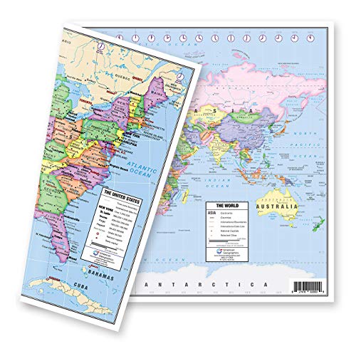
The Lighthouse Geographics desk map combines a pastel US political map on one side with a world map on the flip side, providing a compact, two-in-one learning resource for classroom desks or study corners. The US map clearly delineates all fifty states, includes Hawaii and Alaska as inserts, marks state capitals with red stars, and notes major cities and time zones. The world side presents a concise, current world view suitable for introductory geography lessons, with an emphasized Europe inset for more detailed study. Laminated for durability, it supports dry-erase use in student activities and quick quizzes.
Laminated World Map & US Map Poster Set

This 18″ x 29″ laminated poster set from Palace Learning provides a durable, high-visibility option for classrooms and study spaces. The two-piece wall chart offers a full world map alongside a United States map, enabling side-by-side comparison and quick location checks. The lamination protects against wear in busy classrooms and makes it easy to annotate or personalize with markers during lessons. Updated visuals help keep content relevant for current geography curricula.
JAWO World Map Tapestry

The JAWO World Map Tapestry is a large, visually engaging textile map designed for classrooms and homes. Crafted from premium polyester for durability, it presents a vibrant world map with clearly labeled continents, countries, and major cities. The tapestry format creates a striking focal point on wall spaces while encouraging exploration of global geography. Its bright colors and durable material help it withstand frequent handling by students, making it suitable for daily use in learning corners and bedrooms alike.
Swiftmaps World Premier Wall Map Poster Mural

The Swiftmaps World Premier Wall Map offers a large, 24″ x 36″ laminated poster with 3D shaded relief to emphasize terrain. Folded for portability and transportable education, this map is printed on a 24-lb paper base and features detailed political boundaries, coastlines, and topographic shading. The combination of clear labeling and tactile relief supports both visual and kinesthetic learners, making it suitable for classrooms, libraries, and study spaces where students compare physical geography with political borders.
World Map Poster & US Map For Kids – 2pc Set
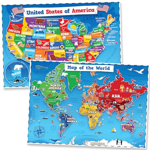
The 2-piece poster set from Momo & Nashi includes a USA map and a world map designed for early learners. With kid-friendly icons, bright, non-overstimulating colors, and large labeling, these posters support early geography concepts, such as continents, major countries, and the U.S. states. They’re well-suited for preschool classrooms, homeschool areas, and playrooms, offering a helpful visual foundation for young students beginning geography education.
Buying Guide: Key Considerations For Choosing Student-Friendly World Maps
- Size and visibility: Choose map formats that fit your space yet remain readable from typical seating distances. Consider desk maps for focused activities and wall maps for whole-class viewing.
- Durability: Laminated posters and cloth or tapestry maps resist wear in busy learning environments. For younger learners, cloth maps reduce fragile edges and tearing risks.
- Detail level: For beginners, a clear political map with country borders and major cities works well. For advanced learners, consider maps with political and physical details, such as terrain shading or inset regions (like Europe) for zoomed study.
- Interactivity: Dry-erase surfaces on laminated maps support quick labeling, quizzes, and guided activities. Tapestries and fabric maps invite pinned notes and student contributions.
- Educational goals: Align map choices with curriculum objectives—US maps to study states and capitals, world maps for continents and countries, and thematic maps for specialized topics (e.g., time zones, cultures).
- Aesthetic fit: Color palettes and design styles influence student engagement. Pastel US maps or bold world visuals can complement classroom decor and reduce visual clutter.
- Child-friendly features: For younger learners, posters with large labels, icons, and intuitive color coding help memory retention and ease of use.
Overall, the best map for students balances legibility, durability, and instructional flexibility. The options above cover a range of learning environments—from compact desk maps for individual practice to large wall posters for group lessons. Each product supports science, history, and geography curricula by making locations, borders, and regions more tangible and memorable for learners at different stages.