Finding the right map for kids blends bright visuals with clear labeling to foster early geography skills. The following selections cover US and world maps in posters, puzzles, wall decals, and interactive formats suitable for classrooms, homeschool spaces, and playrooms. Each option emphasizes durable design, age-appropriate labeling, and visually engaging art to keep young learners focused on continents, countries, capitals, and landmarks. Use this guide to compare formats and choose the best fit for your child or classroom.
| Product | Format | Best For |
|---|---|---|
| World Map Poster & USA Map 2pc Set (Momo & Nashi) | Posters | Toddlers to early learners; classroom decor |
| 2 Pack World & USA Map (Palace Learning) | Posters | Durable laminated posters for classrooms |
| Mapology World Map Puzzle (Imagimake) | Puzzle | Hands-on geography with flags and capitals |
| Mapology USA & World Puzzle (Imagimake) | Puzzle | Integrated USA and world maps with capitals and stickers |
| BEST LEARNING i-Poster World Map | Interactive map | Listening-based learning; interactive country facts |
Note: This overview highlights products designed to support geography learning for children from preschool to early elementary ages. Formats include posters, laminated posters, jigsaw puzzles, and interactive maps, each chosen for clarity, durability, and engaging visuals. Availability and product details may vary by seller.
World Map Poster & USA Map for Kids – 2pc Set
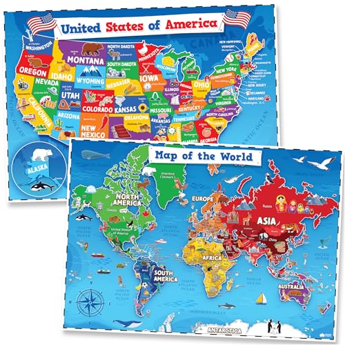
The two-piece set includes a World Map Poster and a USA Map Poster crafted for early learners. Rich, vivid colors and simple labeling help kids distinguish continents, countries, and U.S. states. Designed to be durable for classroom walls or playroom decor, these posters aim to support memory retention and visual learning without overwhelming detail. The artist-style icons add inviting visuals to capture kids’ attention and encourage exploration of geography concepts.
Key features reflect an emphasis on accessible design for toddlers and preschoolers. The posters are suitable for decorating a classroom, playroom, or homeschooling space, providing a visually stimulating way to introduce geography, continents, and basic political boundaries. The big, clear images help reinforce recognition and recall as children connect maps with real-world places. This option balances color, readability, and educational value for early geography curricula.
2 Pack World & USA Map – Laminated

This 2-poster set features laminated maps measuring 18″ x 29″, offering durability for frequent handling by children in classrooms or homes. Laminated finishes resist tearing and make it easier to wipe clean after classroom activities. The design supports a straightforward approach to learning geography with clear labels, making it a practical option for early learners to explore continents, countries, and major geographical features.
The product is purpose-built for classroom and home use, where frequent updates or reuse are common. Laminated posters can be used in rotating wall displays, lesson corners, or as part of a geography center. The two poster images lend themselves to pairings with activities—matching games, labeling exercises, or map-reading challenges—that reinforce memory and spatial awareness in young students.
Imagimake Mapology World Map Puzzle

Imagimake’s World Map Puzzle includes country pieces with flags and capitals, offering a tactile way to learn geography. The puzzle fosters spatial awareness, memory, and problem-solving as children fit country shapes and place flags and capitals in the correct positions. The kit features structured foam puzzle frames and a large layout to support interactive, screen-free learning for kids ages 5-8 and up.
Its design encourages exploration of the world through hands-on play, making it suitable for family game nights, homeschooling, or classroom centers. The included Europe map adds broader geographic context, helping children understand regional relationships. This product appeals to learners who benefit from kinesthetic learning and visual association between country shapes, names, and capitals.
Imagimake Mapology USA & World Puzzle

This jumbo puzzle set includes USA, World, and Europe maps in a single box, combining country-shaped puzzle pieces with flags and capitals. Designed for ages 8-12, it supports a deeper geography understanding through integrated learning of states, countries, and capitals. The puzzle format reinforces spatial awareness, critical thinking, and problem-solving as students match shapes to locations while exploring flag symbolism and geographic relationships.
The puzzles offer a structured, challenging activity that can extend geography lessons beyond basic map recognition. It’s well-suited for students who benefit from multi-map comparisons—seeing how the United States aligns with broader world geography and how capitals relate to their locations. The inclusion of flag stickers provides an additional layer of cultural context and memorization opportunities.
BEST LEARNING i-Poster World Map
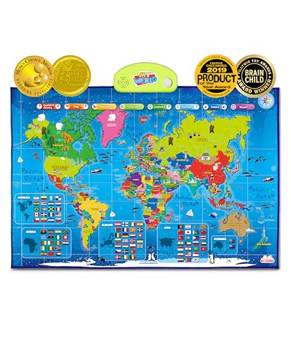
The BEST LEARNING i-Poster is an interactive talking world map designed for kids ages 5-12. Touch a country to hear its name, its capital, and fun facts through a large library of voice-guided questions. This format blends auditory learning with visual mapping, supporting diverse learning styles. The interactive element makes geography feel like an exploration rather than a static lesson, aligning with STEM-oriented education approaches.
Award recognition marks the i-Poster as an education-focused toy that can foster curiosity about countries, oceans, continents, and landmarks. The combination of geographic data and cultural context helps students connect mental maps with real-world places, promoting a broader understanding of global geography and earth science.
World Map Puzzle for Kids – 75 Pieces

Designed for children ages 4-8, this 75-piece world map puzzle forms a detailed layout featuring continents and key landmarks. The finished image measures about 23.6″ x 17″, providing a sizable display for teaching geography concepts while helping develop hand-eye coordination, memory, and spatial reasoning. The puzzle’s colorful design encourages exploration of global geography while supporting fine motor skill development through piece manipulation.
The product also emphasizes family-friendly, screen-free learning. With a bright and approachable design, it’s suitable for homeschooling groups, classroom centers, or family playtime. The puzzle format naturally lends itself to guided activities—labeling continents, naming capitals, or matching landmarks to locations—offering a versatile addition to a geography-focused learning space.
HomeEvolution World Map Peel & Stick Decals
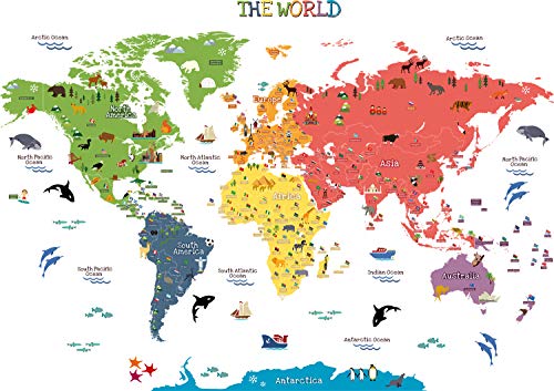
HomeEvolution’s wall decals offer a peel-and-stick world map experience. The decals cover major continents, oceans, and country details with animal and landmark illustrations. This option suits spaces where a more decorative approach is preferred while still providing geographic context. It’s easy to apply on walls in nurseries, playrooms, or classrooms and can be rearranged as learning needs evolve. The included pre-cut elements simplify installation and ensure a clean, adjustable display.
Removable decals provide flexibility for renters or families who may relocate. The visuals are designed to be visually appealing for younger audiences while maintaining essential geographic cues like country shapes, oceans, and notable regions. This option blends educational value with room aesthetics, creating an inviting geography corner that supports ongoing exploration.
Buying Guide: Key Purchase Considerations
- Age range and learning style: Choose formats that match a child’s age and preferred learning method—visual posters for quick reference, puzzles for hands-on learning, or interactive maps for auditory engagement.
- Durability and usage: Posters and decals are durable for wall display, while laminated posters and puzzles withstand frequent handling in classrooms and homes.
- Label clarity and readability: For beginners, clean fonts, distinct color-coding, and large labels reduce cognitive load and aid memory retention.
- Interactivity level: Interactive maps and talking posters engage different senses, which can help memory and curiosity, but may be less appropriate for very young learners sensitive to sound.
- Storage and display: Consider wall space, shelving, and ease of rotation. Some sets pair well with activity centers, while others work best as stationary displays.
- Expansion potential: Puzzles that connect to broader regions (USA, Europe) offer opportunities to expand lessons with cross-map comparisons and geography quizzes.
- Theme consistency: If teaching multiple regions, selecting products with complementary artwork and color schemes can create a cohesive geography corner.
In sum, the best map for kids balances engaging visuals with clear geographic information, supports multiple learning styles, and fits your space and curriculum. Whether you prefer flat posters, durable laminated prints, interactive maps, or hands-on puzzles, these selections provide a range of approaches to help children discover the world with confidence.